《TAIPEI TIMES》 Rare map shows Qing era Aboriginal and Han areas

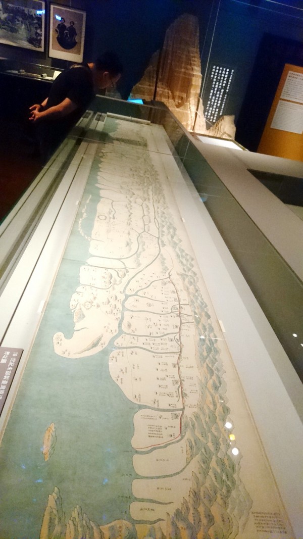
A man looks at a map dating from the late 18th century demarcating zones in western Taiwan inhabited by different ethnic groups at the National Museum of Taiwan History in Tainan on Thursday last week. Photo: Liu Wan-chun, Taipei Times
GRAPHIC TREASURE: The map, which it would have taken up to five years to draw, is one of 70 ancient cartographic pieces exhibited at the National Museum of Taiwan History
By Liu Wan-chun and Jake Chung / Staff reporter, with staff writer
One of only six known maps remaining in the world that demarcate zones of residence of the Han from those of the Aborigines on Taiwan during the Qing Dynasty is being exhibited at the National Museum of Taiwan History in Tainan.
The Demarcation Map (界址圖), was created by Qing cartographers to detail the separation of residential zones, and each map would have required three to five years of research and drawing to complete, Museum assistant researchers Chen Ming-hsiang (陳明祥) and Chen Yu-chen (陳玉珍) said.
The six known maps of the kind are kept at museums or research facilities in Taiwan, China, the UK and Russia, the researchers said, adding that the map on display at the Tainan museum is part of the private collection of Sinologist and painter Hou Chin-lang (侯錦郎), who resides in France.
Academia Sinica is in possession of another demarcation map, the researchers added.
The map details the demarcation of zones at the end of the 18th century, around the time when the Qing Empire implemented a policy to separate the zones, building borders and digging ditches to create physical boundary lines, the researchers said.
The policy was enacted in response to problems with Han ethnic rebels and increasing clashes between Han and Aboriginal people, the researchers said.
The Han arrived in Taiwan in the 17th century and by the 18th century their colonization efforts were encroaching on the foothills of the eastern mountain range, further compressing the living space of Aborigines, the researchers said.
Following the Zhu Yigui (朱一貴) rebellion in 1721, the Qing Empire declared further measures to demarcate areas and restrict access to mountainous areas, the researchers said.
However, as Han colonization progressed on the island, demarcation lines were changed at least four times under Emperor Qianlong (乾隆) of the Qing Dynasty, they said.
It was during this stage that the formerly nominal lines on paper were actually enforced by digging ditches as deep as 1.8m and establishing guard posts on the borders, the researchers said.
The exhibit, which started on Friday and is to run until Aug. 12, also features more than 70 other ancient maps, including a map of Taiwan drawn under Emperor Daoguang (道光帝), who reigned from 1820 to 1850, and maps marking areas managed by Presbyterian missionaries in the final years of the Qing Empire, the museum said.
It also features a scaled-down version of the ditches that separated the Han and Aboriginal populace, it added.
新聞來源:TAIPEI TIMES


